real-time interactive map:
the reason Florida water so much warmer than California’s
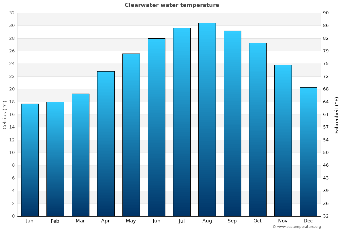
indeed i was shocked by how hot the water was at Clearwater.
i never went to swim on the beach when i lived in California for a year but i did feel the water and didn’t think much of it at the time …
looking at the map now i see in NYC water is currently 74F while in LA it is 72F so almost the same, which is why when i drove from NYC to California in the Summer and felt the water there i didn’t think much of the temperature … because it was basically the same as what i was used to …
but when two days ago i felt the water at Clearwater beach in Florida i almost couldn’t believe it - it was HOT. not dangerously hot but probably hotter than you would want when you’re trying to cool off from 95F heat and sun …
i am such a fucking idiot for never thinking of this before.
currently ( late August, late afternoon Eastern Time ):
Boston - 67F
LA - 72F
NYC - 74F
Tampa ( Clearwater ) - 89F
WOW
it’s crazy that water in NYC beach is warmer than LA beach or that Tampa is 17 degrees warmer than LA in terms of beach water temperature.
water isn’t like air - you can feel even 2 or 3 degrees difference in water temperature. 89F = therapy pool. 72F = cold shower. HUGE difference. YUGE ! ! !
i can’t believe i am only learning about this now.
wow i am dumb.
and here is the craziest thing - beach water is warmer in Florida in November than it is in Los Angeles in August

however in winter California and Florida water temperatures are about the same - which doesn’t matter much since you’re not going to the beach in Winter …
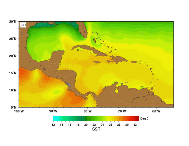
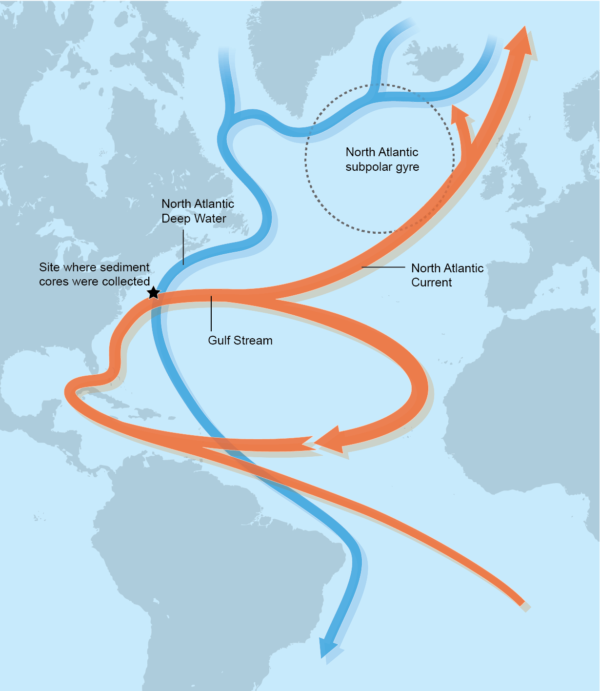
about Gulf Stream …
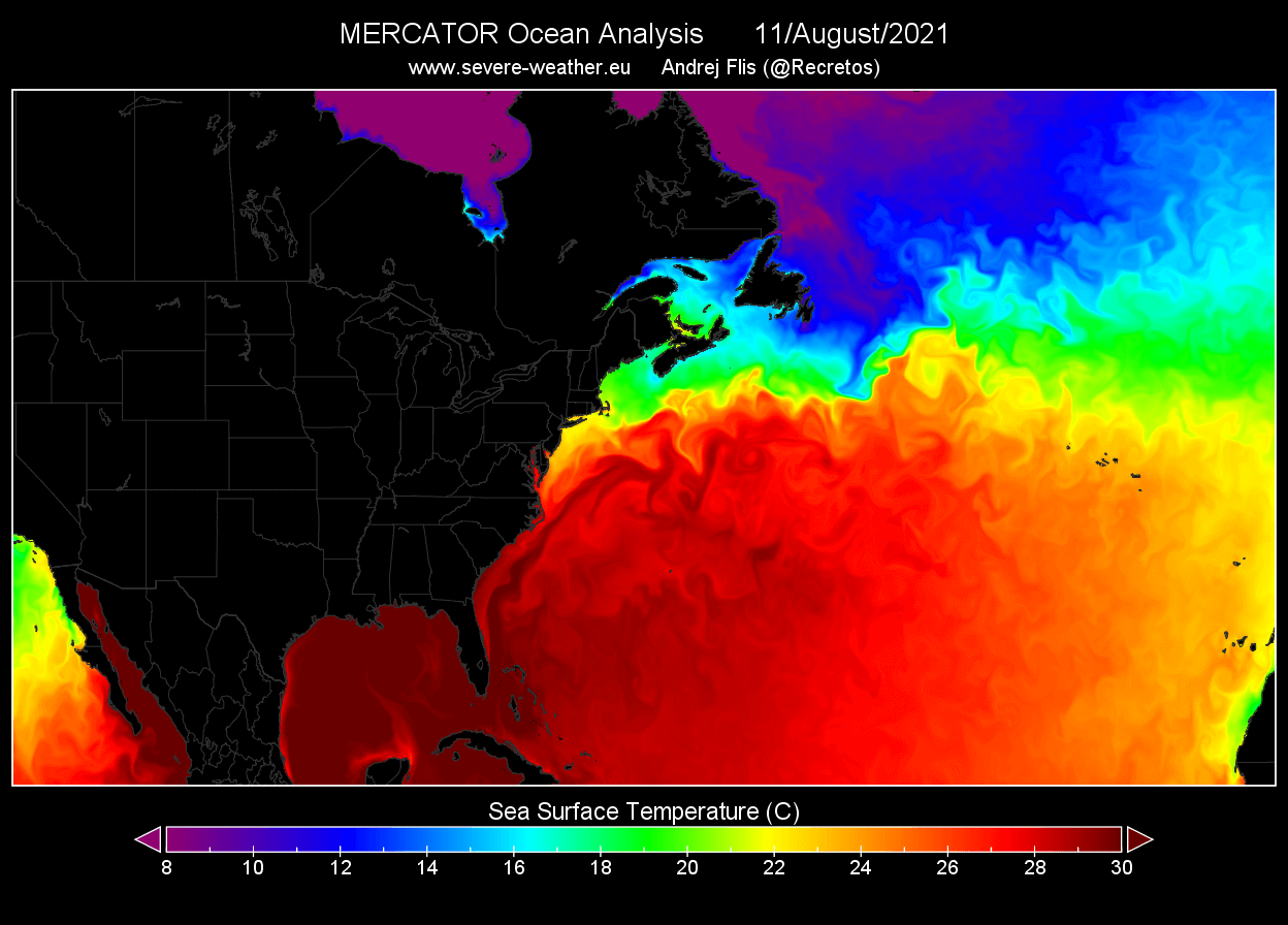
August:
February:
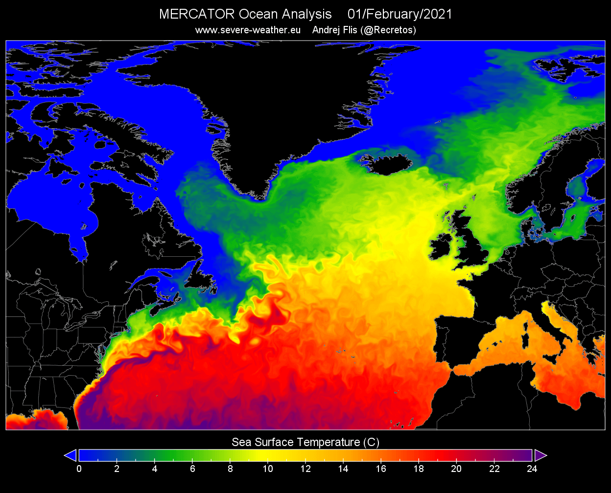
as you can see from August to February there is only a few degrees ( Celsius ) of difference in water temps around Florida … this moderates the air temperatures in that coastal region.
i read an article about maintaining golf courses in Florida and the guy who does it says just 5 miles distance from the coast already requires different practices for maintaining the grass in winter compared to a golf course that is right next to the ocean …
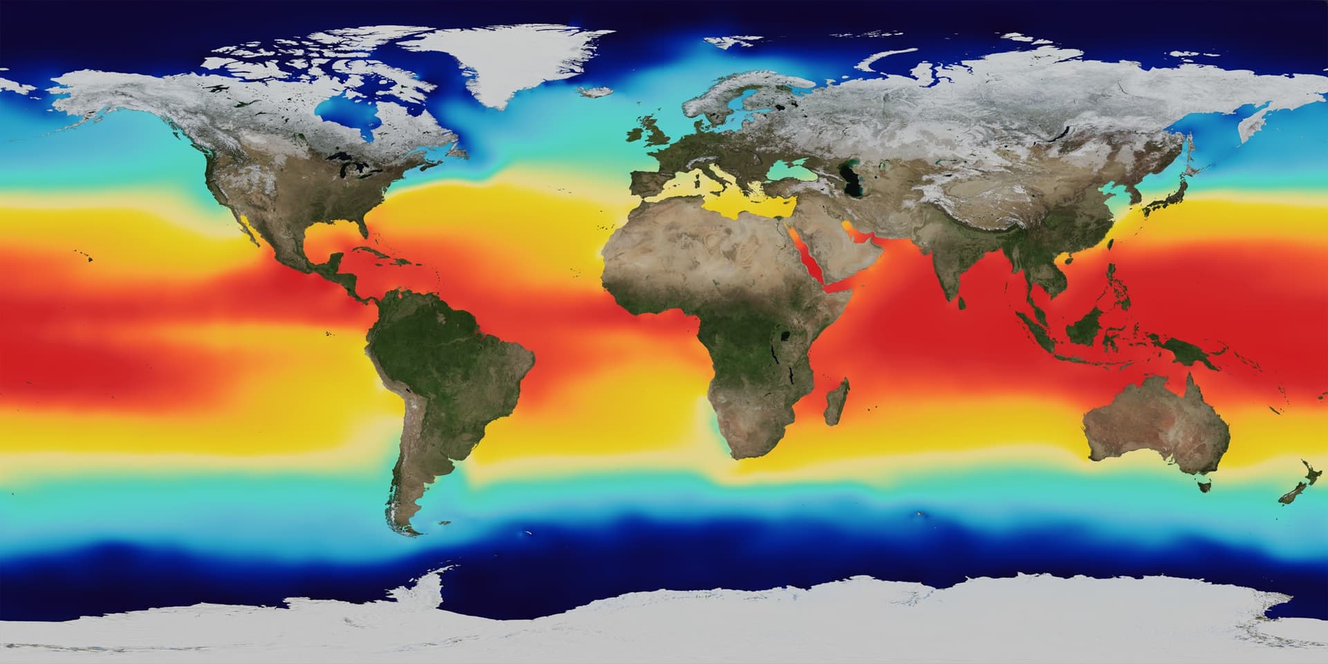
average January surface temps over 42 years
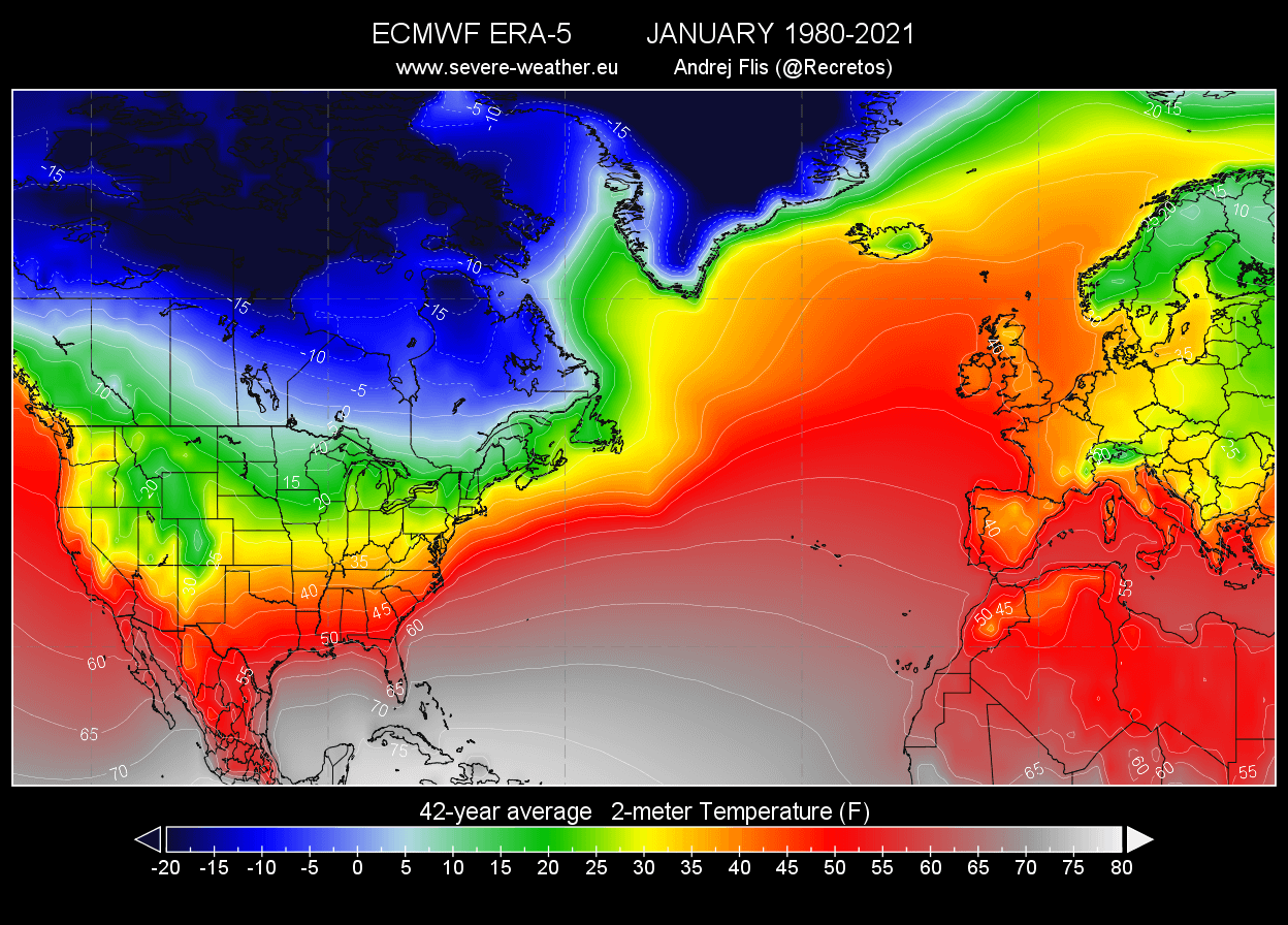
note this image also shows LAND surface temps and you can clearly see how ocean currents drive land temperatures in the coastal regions …
which is why you want to live in a coastal region to begin with - the moderating effects of ocean’s thermal mass on temperatures …
basically you have to consider:
1 - proximity to the ocean
2 - ocean currents
3 - any major mountains ( like Rocky Mountains ) that act as Air Dam
with those basics you can begin to understand the climate of a region and can start to look at specific numbers …
if you just look at numbers it may be hard for you to wrap your mind around them …
at the same time without numbers you can’t do calculations …
so IMO you need both the intuitive / visual and the quantitative / numeric …
Caribbean water temperature month by month ( Animated GIF )